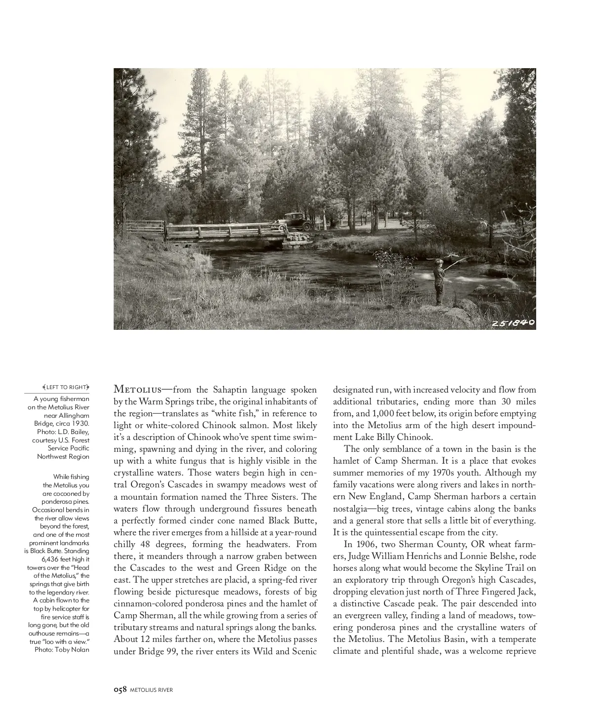
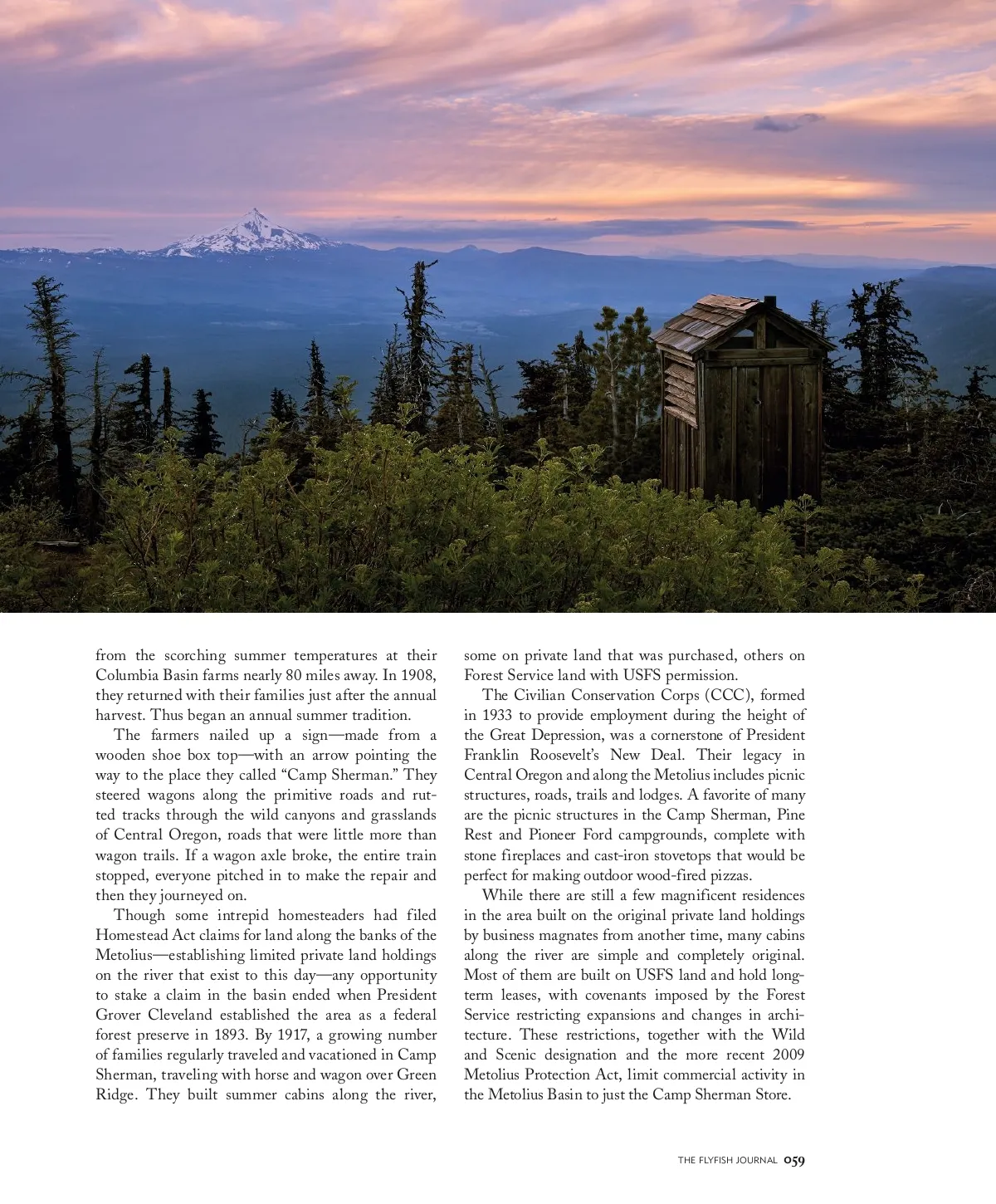
LEFT TO RIGHT Metolius— from the Sahaptin language spoken by the Warm Springs tribe, the original inhabitants of the region—translates as “white fish,” in reference to light or white-colored Chinook salmon. Most likely it’s a description of Chinook who’ve spent time swim-ming, spawning and dying in the river, and coloring up with a white fungus that is highly visible in the crystalline waters. Those waters begin high in cen-tral Oregon’s Cascades in swampy meadows west of a mountain formation named the Three Sisters. The waters flow through underground fissures beneath a perfectly formed cinder cone named Black Butte, where the river emerges from a hillside at a year-round chilly 48 degrees, forming the headwaters. From there, it meanders through a narrow graben between the Cascades to the west and Green Ridge on the east. The upper stretches are placid, a spring-fed river flowing beside picturesque meadows, forests of big cinnamon-colored ponderosa pines and the hamlet of Camp Sherman, all the while growing from a series of tributary streams and natural springs along the banks. About 12 miles farther on, where the Metolius passes under Bridge 99, the river enters its Wild and Scenic A young fisherman on the Metolius River near Allingham Bridge, circa 1930. Photo: L.D. Bailey, courtesy U.S. Forest Service Pacific Northwest Region While fishing the Metolius you are cocooned by ponderosa pines. Occasional bends in the river allow views beyond the forest, and one of the most prominent landmarks is Black Butte. Standing 6,436 feet high it towers over the “Head of the Metolius,” the springs that give birth to the legendary river. A cabin flown to the top by helicopter for fire service staff is long gone, but the old outhouse remains—a true “loo with a view.” Photo: Toby Nolan designated run, with increased velocity and flow from add it iona l t r ibuta r ies, end ing more t ha n 30 mi les from, and 1,000 feet below, its origin before emptying into the Metolius arm of the high desert impound-ment Lake Billy Chinook. The only semblance of a town in the basin is the hamlet of Camp Sherman. It is a place that evokes summer memories of my 1970s youth. Although my family vacations were along rivers and lakes in north-ern New England, Camp Sherman harbors a certain nostalgia—big trees, vintage cabins along the banks and a general store that sells a little bit of everything. It is the quintessential escape from the city. In 1906, two Sherman County, OR wheat farm-ers, Judge William Henrichs and Lonnie Belshe, rode horses along what would become the Skyline Trail on an exploratory trip through Oregon’s high Cascades, dropping elevation just north of Three Fingered Jack, a distinctive Cascade peak. The pair descended into an evergreen valley, finding a land of meadows, tow-ering ponderosa pines and the crystalline waters of the Metolius. The Metolius Basin, with a temperate climate and plentiful shade, was a welcome reprieve 058 METOLIUS RIVER
The Flyfish Journal Volume 13, Issue 2: Page 58